Chart of the Day
Geography 1.0
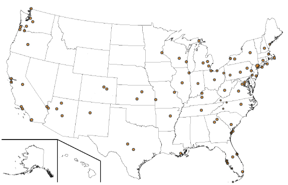
This map highlights at least 80 locations I have traveled to either by car or plane. Estimates are that each visit was for multiple purposes: work and travel; travel and work; work and exploration; exploration and work; exploration and vacation; baseball game and art museums and ... anything else. Future updates of this work in progress will identify which locations were which reasons. Some notable locations includes Key West, FL (90 miles away from Cuba), Manhattan, Portland, Maine and Oregon, White Fish Point, Mich. and Point Roberts, Wash.
This mapping journal will also update which journeys are added to the list as well as the journeys that required a US passport. While early statistics indicate most identified points of interest in the U.S. were via flights, it does appear that much of our travels included driving along something called "Route 66". So I suggest you plan on getting your kicks along some of those journeys.
-- Peace --
Previous
Charts
(aka
"Cognitive Preferred
Therapy")
| 6/9/2019 | The Trail of One Super Survivor |
| 6/1/2019 | What My Daily Regiment Is Like |
| 8/5/2016 | Circle of Trust |
| 6/2/2016 | Travel is Therapy |
| 5/15/2016 | Defense Condition |
| 4/26/2016 | I Want A New Drug |